A Personal Portfolio and Professional Profile Website Dedicated to Showcasing Experience and Work, Without Generating Any Revenue or Serving Any Commercial Purpose.
A Personal Portfolio and Professional Profile Website Dedicated to Showcasing Experience and Work, Without Generating Any Revenue or Serving Any Commercial Purpose.
Over 24 Years of Academic and Professional Experience
Specializing in Geographic Information Systems (GIS) and Remote Sensing, with extensive academic and professional experience in geospatial data analysis, spatial sciences, and their diverse applications.
2002
Bachelor's Degree in Geographic Information Systems (GIS)
2007
Specialized Diploma in Surveying
2022
Master's Degree in Geographic Information Systems (GIS)
2025
PhD in Infrastructure and Geomatics
Smart Geospatial Platform
Geospatial Platform for Surveying
Smart Coordinate Conversion System
(KTM, Automatic UTM 38/39, WGS84)
with Distance Measurement, Navigation, and Live GPS Tracking
Control & Navigation Panel:
📡
GPS Status
Inactive
🎯
Live Distance
Unavailable
🌐
Your Current Location
Waiting for GPS
💡
Note:
Click the map or enter coordinates to select a point,
then select My Current Location to enable GPS and calculate live distance.
Ready to use...
For Professional, Academic, or Research Inquiries
خدماتى
خدمات نظم المعلومات الجغرافية والاستشعار عن بعد
حلول مكانية دقيقة لدعم المؤسسات والمشاريع البحثية والهندسية والتخطيطية.
التدريب والاستشارات
برامج تدريبية متخصصة واستشارات فنية للمؤسسات والأفراد في برمجيات GIS والاستشعار عن بعد.
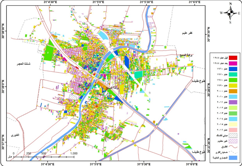
An applied study demonstrating the use of Geographic Information Systems (GIS) in analyzing infrastructure services and projects to support planning and decision-making.